 Nile Cruisen Team
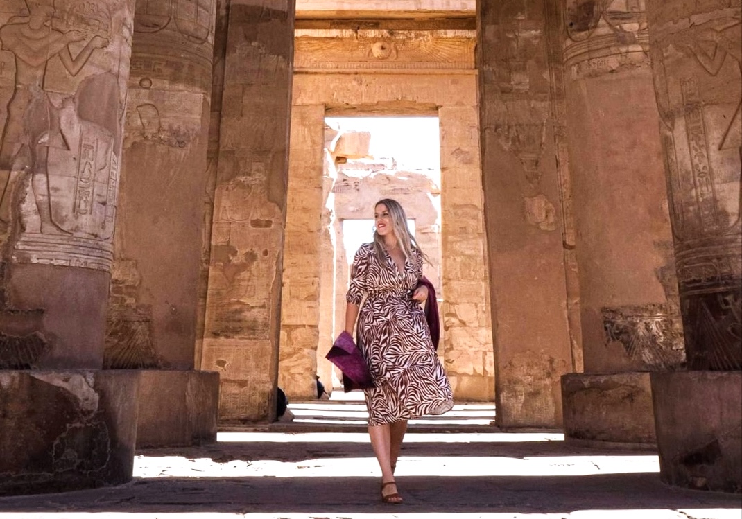
Egypt is a country with extensive deserts and a river that gives life to the soil, ancient monuments alongside fertile agricultural land, and a geographical position connecting two continents. The geography of Egypt has played an important role in shaping its history, culture, agriculture, settlement, and trade.
Egypt, located in northeastern Africa, is most famous for the Nile River, the Sahara Desert, the pyramids of Giza, and the ancient civilization that has developed along the riverbanks of the Nile. Nevertheless, its landscapes also comprise the fertile Nile Delta, the rugged mountains of the Eastern Desert, the Sinai Peninsula, and coastlines along both the Mediterranean Sea and the Red Sea.
A better understanding of Egypt’s physical geography helps to explain how one of the world’s most well-known ancient civilizations developed and why the Nile continues to play a central role in Egypt’s identity and development. It also helps travelers to appreciate the landscapes and historic sites that they can explore on the Nile.
Table of Contents:
-
Where is Egypt Located Geographically?
-
What is the Physical Geography of Egypt?
-
How Did Geography Affect the Development of Ancient Egypt?
-
How Did Geography Protect Ancient Egypt?
-
What Is the Climate of Egypt Like?
-
What is the Physical Geography of Cairo, Egypt?
-
What Is the Geography of Egypt and Asia?
-
What is the Most Important Geographical Feature of Egypt?
-
What Is the Geography of Egypt for Kids?
-
How Can You Explore Egypt’s Geography on a Nile Cruise?
-
Frequently Asked Questions
Where is Egypt Located Geographically?
Egypt is located in the northeastern part of Africa, and it shares land boundaries with Libya to the west, Sudan to the south, and Israel and the Gaza Strip to the northeast. The Mediterranean Sea lies to the north, and the Red Sea and Gulf of Aqaba lie along its east side.
Egypt is also a transcontinental country since the Sinai Peninsula extends to Asia. The Suez Canal connects the Mediterranean Sea with the Red Sea and forms a major sea route between Europe and Asia. Because of its geographical position, Egypt has always been an important crossroads for trade, migration, and cultural exchange.
Its location also allows tourists to enjoy a variety of experiences within the same country. Cairo and Giza have ancient monuments and urban sights, whereas Luxor and Aswan show the temples, tombs, and river scenery of Upper Egypt. The coastal areas give a different view of the nation’s natural environment.
What is the Physical Geography of Egypt?
The physical geography of Egypt is mainly composed of desert areas, the Nile River Valley, and the Nile Delta. Even though the country has a large area, the majority of its population and agricultural activities are located near the Nile since the remaining lands receive very little rainfall.
Egypt’s main geographical regions include the following:
-
The Nile River Valley and Delta
The Nile is the most important geographical feature of Egypt. It flows through Egypt from south to north before branching out across the Nile Delta and emptying into the Mediterranean Sea. For thousands of years, its water has been used for agriculture, to support settlements, and for transportation.
South of Cairo, the Nile Valley is a fairly narrow band of fertile land lying between deserts. Near Cairo, the river splits into several branches, which extend over the broad, fertile delta.
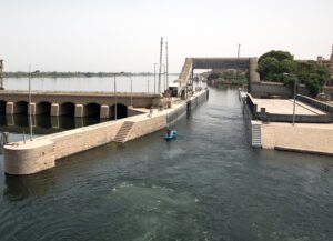
The Nile Delta contains productive farmland, canals, and waterways. In the past, the sediment brought by the river has helped to replenish the soil and enable the growing of crops, while at present irrigation systems and the Aswan High Dam are important in the management of water supplies.
-
The Western Desert
The Western Desert is part of the Sahara and takes up a large part of Egypt’s territory; it extends from the western side of the Nile Valley to the Libyan border. Its landscapes have sand dunes, rocky plateaus, depressions, and scattered oases. Places including Siwa, Bahariya, and Farafra show a marked contrast between the desert landscapes and pockets of vegetation and water.
The Western Desert has influenced settlement patterns since permanent communities place great importance on having access to water; at the same time, its huge open areas provide opportunities for exploring the desert and visiting distant natural landscapes.
-
The Eastern Desert
The Eastern Desert, located between the Nile Valley and the Red Sea, is an area with rock highlands, mountains, wadis (dry valleys), and mineral deposits.
The Red Sea Hills comprise a large part of this area. Historically, the Eastern Desert was used as a connection between the Nile Valley and the Red Sea coast despite the difficulties due to the dry climate of the area.
-
Sinai Peninsula
The Sinai Peninsula connects northeastern Africa to southwestern Asia. It is bordered by the Mediterranean Sea to the north, the Gulf of Suez to the west, and the Gulf of Aqaba to the east, with the Red Sea to the south.
Sinai has varied topography, including sandy plains, plateaus, wadis (dry valleys), and mountains. Mount Catherine, with an elevation of about 2,642 meters, is the highest mountain in Egypt. Being positioned between Africa and Asia has made the Sinai Peninsula significant in trade, travel, and maintaining connections.
How Did Geography Affect the Development of Ancient Egypt?
Geography played an important role in the development of ancient Egyptian civilization since the combination of the Nile River, the fertile soil, the warm climate, and the surrounding deserts enabled people to carry out agriculture, build settlements, and create a powerful civilization.
The Nile Provided Water and Fertile Soil
Ancient Egypt developed along the Nile since the surrounding desert got very little rainfall and the river provided water for drinking, farming, fishing, and everyday use.
Before the construction of modern dams, seasonal flooding spread water and nutrient-rich sediment over parts of the floodplain; as the floodwater receded, the resulting fertile soil supported the growth of crops, including wheat and barley.
The surplus of food produced by agriculture was able to support growing populations, specialized workers, religious institutions, and royal administrations. Thus, the river supported more than just farming; it also helped to establish the economic foundation of ancient Egyptian society.
The River Supported Transportation and Trade
The Nile acted as a natural transport route linking the different settlements in Egypt; boats were used to carry agricultural products, building materials, goods, and people between the various communities.
The river links various parts of the country to trade networks that reached into adjacent areas. The flow of goods and people encouraged economic activity and enabled the rulers to keep contact throughout their territories.
Geography Influenced Religion and Culture
The natural environment has influenced how ancient Egyptians understood life and death. The contrast between the fertile land next to the river and the dry desert lying beyond it became an important part of their worldview.
The seasonal changes of the Nile were linked with renewal and an increase in agricultural production. Since the land was fertile, it could support everyday life, and the surrounding desert regions provided sites for tombs and large burial complexes.
Geography also influenced the locations chosen for temples, settlements, and royal monuments. Today many of these ancient sites are still possible to visit, especially in the areas of Luxor, Aswan, and Giza.
How Did Geography Protect Ancient Egypt?
The geography of Egypt included a number of natural obstacles, which restricted access to certain areas of the ancient kingdom; although they were used for defensive purposes, they did not make it impossible for Egypt to be invaded.
Large-scale movement was difficult in the Sahara and the surrounding areas since travelers needed a reliable source of both water and supplies. Settlements and the concentration of resources were confined to a fairly narrow belt in the Nile Valley, while deserts formed barriers on either side.
The Mediterranean Sea lying to the north and the Red Sea to the east also had an effect on the movement of both into and out of Egypt, and at the same time the routes via Sinai and the Nile Valley remained important connections with adjacent areas.
Egypt’s geographical situation at times assisted it in defending the territory, but its history has also seen invasions and periods under foreign rule. While geography gave it advantages, it did not provide complete protection.
What Is the Climate of Egypt Like?
Egypt has a predominantly hot and dry desert climate. Most of the country experiences abundant sunshine, very little rainfall, and hot summers; in winter, the weather is usually milder, though there are differences in temperatures between the coastal areas, the inland cities, and the mountainous regions.
The northern part of the Mediterranean generally gets more rainfall and is more humid than the southern part of Egypt; further south, towards places such as Luxor and Aswan, the conditions are usually drier and feature high daytime temperatures in summer. Spring can bring hot, dusty winds known as khamsin winds, and these can have an impact on visibility and outdoor comfort.
For travelers, these differences matter when planning sightseeing. The cooler months from October to April are generally a good time for exploring Egypt’s outdoor archaeological sites and for taking a cruise on the Nile. Yet the real conditions will differ according to the month and the destination.
While planning a trip to Egypt, you should carry water, wear comfortable clothes, use sun protection, and schedule your outdoor activities in accordance with the temperature during the day to prepare for the strong sunshine.
What is the Physical Geography of Cairo, Egypt?
Cairo is situated in northeastern Egypt, near the place where the Nile valley spreads out into the Nile Delta, and because of its position, the city has developed into a major economic and transportation center.
The landscapes around it include the Nile River, urban areas, farmland, and the adjacent desert plateau; the river is a major geographical feature, and the dry climate has an effect on water use, vegetation, and the character of the land around it.
Cairo’s location also makes it a useful starting point for travelers who want to explore Egypt’s major attractions. Travelers can experience the capital and Giza Plateau before continuing south to Luxor and Aswan for a Nile cruise.
What Is the Geography of Egypt and Asia?
Egypt is an African country, though it does have territory in Asia through the Sinai Peninsula. The Suez Canal crosses the Isthmus of Suez, providing a major maritime route between the Mediterranean Sea and the Red Sea, strengthening Egypt’s role in international shipping and in regional trade.
Sinai also links Egypt to the wider landscapes of southwestern Asia. The deserts, mountains, and coast are very different from the Nile Valley, highlighting the country’s geographical diversity.
What is the Most Important Geographical Feature of Egypt?
The Nile is generally regarded as Egypt’s most important physical feature, as it provides the country’s water supply, enables agriculture, provides the basis for its population centers, and has been central to Egypt’s history and development.
Without the Nile, much of Egypt would be much more difficult to inhabit because of the region’s arid climate. The river also provides a fertile corridor through the desert and broadens into the productive Nile delta in the north.
Its importance extends beyond the historical aspects. The Nile remains essential to modern-day communities and provides a unique way for the traveler to experience the country and its landscapes and heritage.
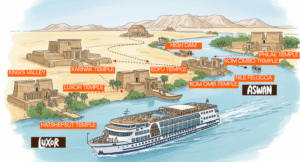
A cruise on the Nile between Luxor and Aswan is a good opportunity to observe the relationship between the river, farmland, desert, and the historic temples.
What Is the Geography of Egypt for Kids?
Egypt is a country in northeastern Africa and is predominantly desert. The Nile runs through it from south to north before reaching the Mediterranean Sea.
Here are five simple facts about Egypt’s geography:
The Nile River: It provides water for people, for farming, and for animals.
The Sahara Desert: A large part of Egypt is in fact desert.
The Nile Delta: The river spreads out into a number of branches just before reaching the Mediterranean Sea, creating some of the most fertile land in the region.
The Sinai Peninsula: This is Egyptian territory in Asia.
Climate: Egypt is generally hot and dry, with more rain along the northern coast.
The Nile was used by the Ancient Egyptians to grow their food, to travel by boat, and to build their settlements. It was the river that enabled the civilization to thrive in an otherwise very dry land.
How Can You Explore Egypt’s Geography on a Nile Cruise?
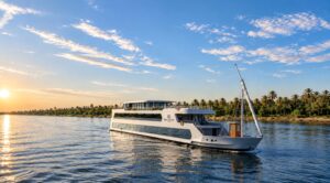
Reading about Egypt’s geography is the key to understanding its history, though experiencing the country in person can make these connections more memorable. A cruise on the Nile between Luxor and Aswan will take you through Upper Egypt, the river passing through fertile fields, palm groves, desert hills, and ancient settlements.
Along the way, you may get an opportunity to visit the spectacular archaeological sites of Karnak Temple, Luxor Temple, Edfu Temple, Kom Ombo Temple, and Philae Temple. Each of these in its own way provides a very different perspective on the way the ancient Egyptians built their temples and their settlements in the Nile Valley.
Travelers can also combine a Nile cruise with a visit to Cairo and Giza to see the pyramids and the other major sights. That gives you a much wider view of Egypt, from the capital and the Nile Delta through to the temples and the river landscapes of the south.
At Nile Cruisen, you can choose from a range of Nile River cruises, including luxury, deluxe, standard, and Dahabiya. You can also choose combined Egypt tour packages that include Cairo, Giza, Luxor, and Aswan.
Ready to see Egypt beyond the guidebooks? Take a look at the available Nile cruise itineraries or get in touch with the Nile Cruisen team to discuss a trip that would suit your travel dates, your interests, and your preferred cruise experience.
Frequently Asked Questions
What is the geography of Egypt?
Egypt is a country in northeastern Africa (with the Sinai Peninsula extending into Asia). The country is dominated by the Nile River valley and the Nile Delta, the Western and Eastern Deserts, a number of mountain ranges, and the Mediterranean and Red Sea coastlines.
How did the geography of the area affect the development of Egypt?
The Nile provided water, fertile soil, and transport routes, which in turn enabled agriculture, trade, and the establishment of permanent settlements. The deserts on either side acted as natural barriers and in part determined the location of the communities and the positions of their defenses.
What is the most important geographical feature of Egypt?
The Nile is, of course, Egypt’s most important physical feature, as it provides the country with agriculture, drinking water, settlements, and transport. It was the bedrock of ancient Egyptian civilization.

This article was created by the team at Nile Cruisen, one of the best tour operators in Egypt for Nile cruises and tailor-made Egypt tours.
With years of experience sailing between Luxor and Aswan, our team knows the Nile better than anyone.
We share trusted travel advice, from the best time to visit and what to pack to simple tips for avoiding crowds.
Our goal is to help you enjoy the timeless beauty of Egypt with comfort, confidence, and an unforgettable travel experience.
- Nile Cruisen Team

- Nile Cruisen Team

- Nile Cruisen Team

- Nile Cruisen Team